Pictorial Maps
Collection of illustrated maps and aerial view drawings made for various projects and clients
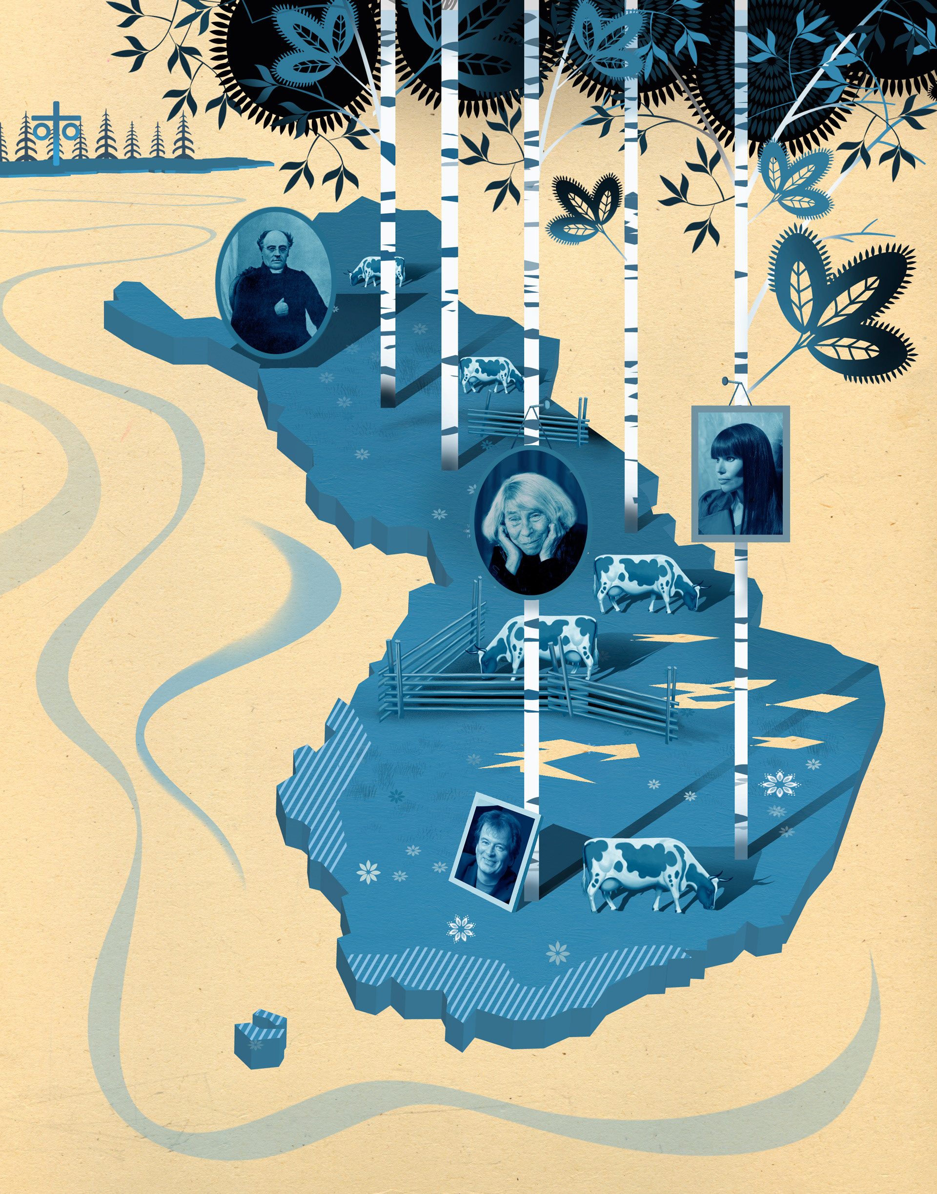
1–2. Growing Sea | Illustration for an article about Finland-Swede authors turning their backs on the "Swedish homeland" | Client: Tidningen Vi (magazine) | 2009
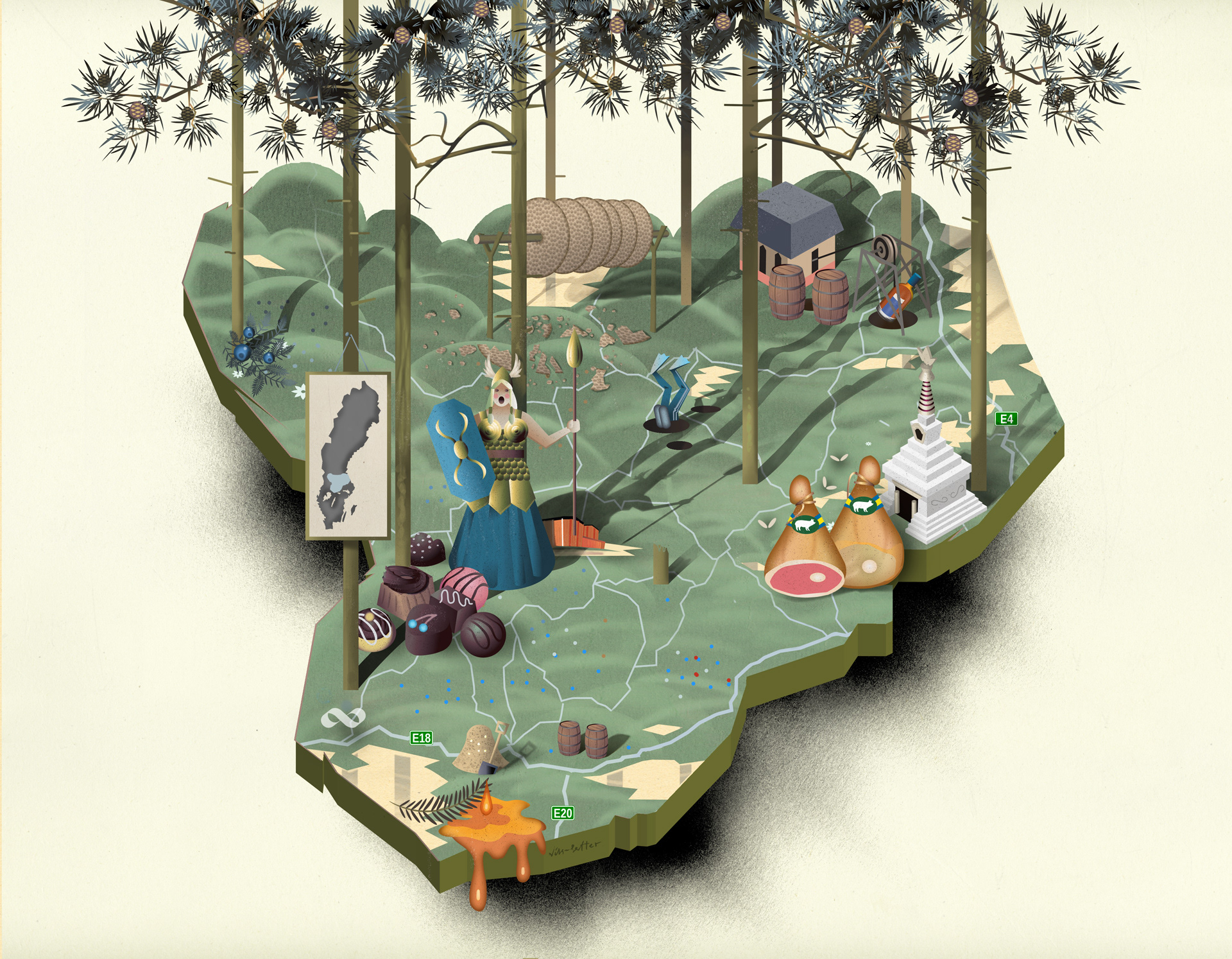
3–8. Bergslagen | Maps over mining district Bergslagen and its attractions (everything from deceased transexual bandoleros to closed goldmines and local food restaurants) | Client: Filter Magazine and Interest Group Bergslaget | 2010 & 2011
9. Skåne | Map over Skåne region showing public transportation by bus and train | for advertisement | Client:
GivAkt Information and Skånetrafiken | 2011
10–11. Täby | Map showing future house development areas in Täby Municipality | Client: Clinton Agency &
Täby Kommun | 2011
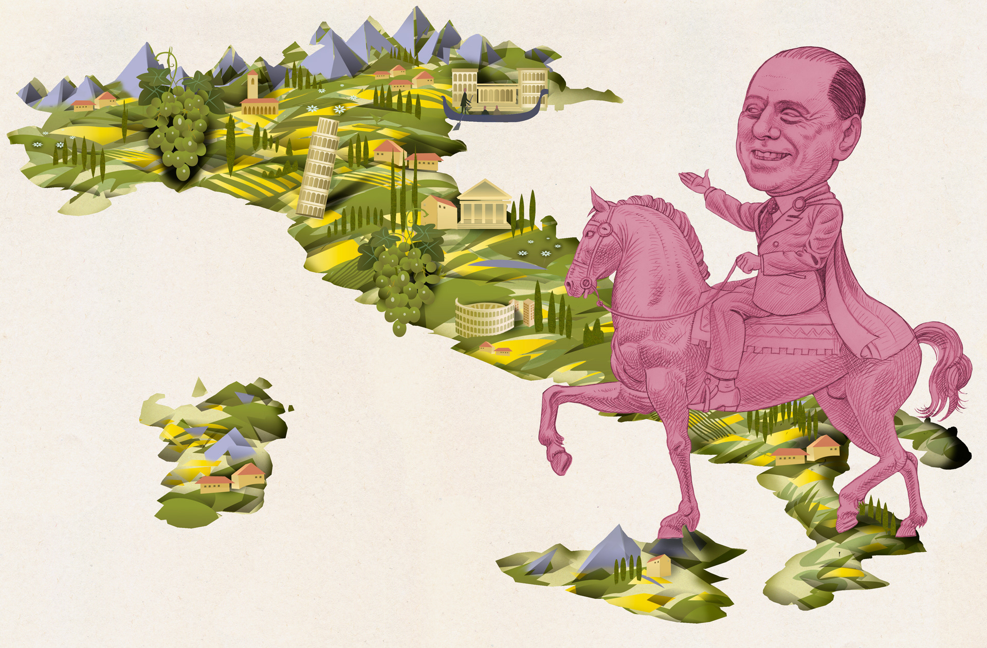
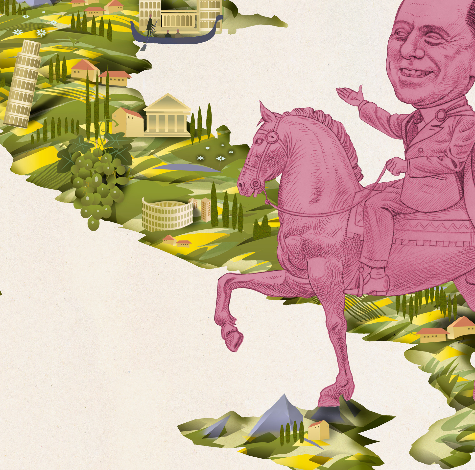
12–13. Berlusconi | illustration for article about this bizzare character | Client: Tidningen Vi | 2010
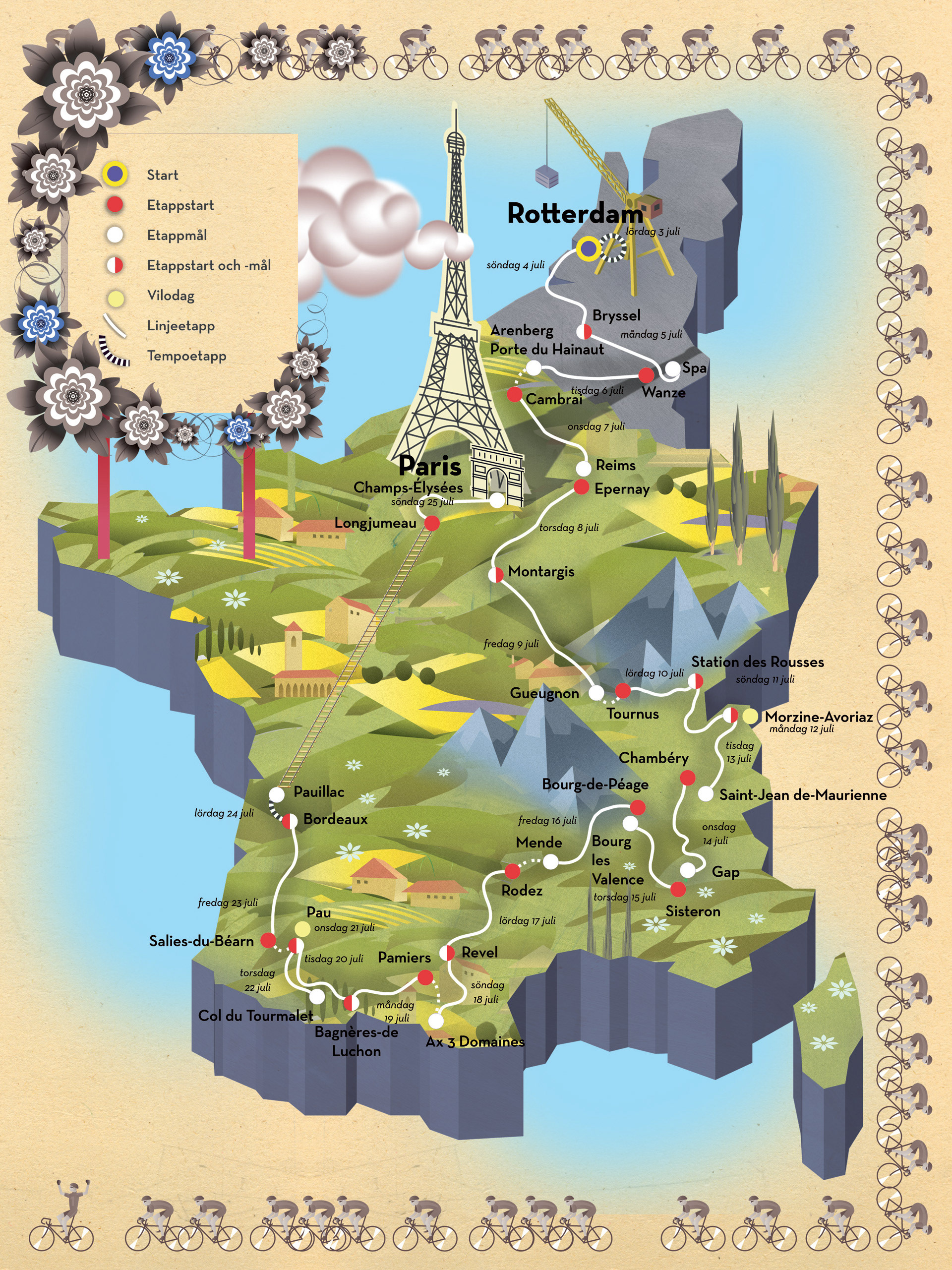
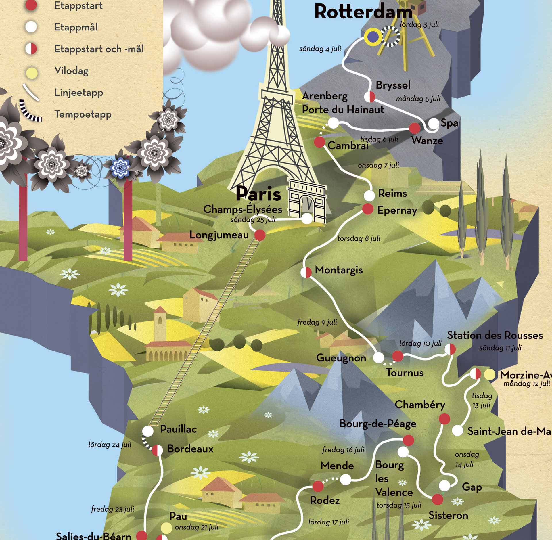
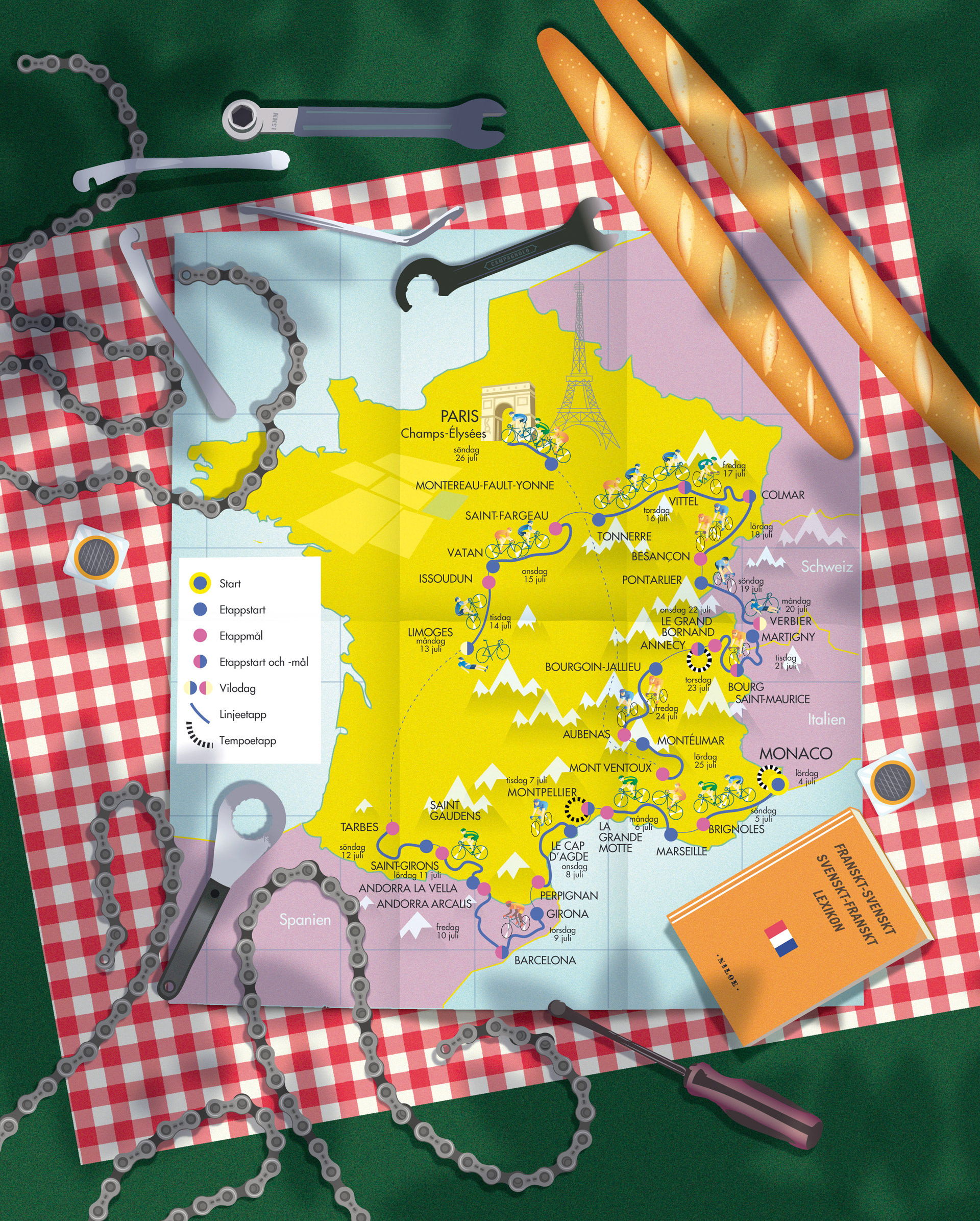
14–16. Tour de France 2009 & 2010 | Client: Kadens Magazine | 2009 & 2010
17. Iranian government and the Revolutionary Guard | from Coca-Cola smuggling to crackdowns on protesters | Client: Frihet Magazine | 2010
Collection of illustrated maps and aerial view drawings made for various projects and clients
1–2. Growing Sea | Illustration for an article about Finland-Swede authors turning their backs on the "Swedish homeland" | Client: Tidningen Vi (magazine) | 2009
3–8. Bergslagen | Maps over mining district Bergslagen and its attractions (everything from deceased transexual bandoleros to closed goldmines and local food restaurants) | Client: Filter Magazine and Interest Group Bergslaget | 2010 & 2011
9. Skåne | Map over Skåne region showing public transportation by bus and train | for advertisement | Client:
GivAkt Information and Skånetrafiken | 2011
10–11. Täby | Map showing future house development areas in Täby Municipality | Client: Clinton Agency &
Täby Kommun | 2011
12–13. Berlusconi | illustration for article about this bizzare character | Client: Tidningen Vi | 2010
14–16. Tour de France 2009 & 2010 | Client: Kadens Magazine | 2009 & 2010
17. Iranian government and the Revolutionary Guard | from Coca-Cola smuggling to crackdowns on protesters | Client: Frihet Magazine | 2010